
Wave model application developed off the Rauma coast
Wave models are used to forecast waves conditions in the open sea and in coastal areas to improve maritime safety. In the ISTLAB project a coastal wave model application is being developed off the coast of Rauma.
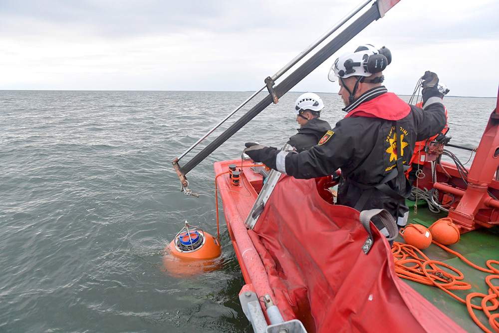
Text: Laura Tuomi, Finnish Meteorological Institute | Photo: Pekka Lehmuskallio
The Finnish Meteorological Institute currently uses the wave forecast system to predict wave conditions in the Baltic Sea. Wave forecasts provide seafarers with valuable information on sea state, but the current methods and grid resolutions used to simulate the open-sea wave conditions do not always function in the Finnish coastal areas, with their complex seabed topography, irregular shoreline and archipelago. New model applications are constantly being developed, and at present more accurate forecasts are produced for the Archipelago Sea and off the coast of Helsinki.
To be able to evaluate the accuracy of the wave model in coastal areas and fairways, we need to have measurements. These have now been made within the ISTLAB project off the coast of Rauma.
A coastal wave model application is also being developed in the ISTLAB project. The aim is to model the wave conditions of the Rauma fairway for shipping and pilotage purposes, based on the international WAVEWATCH III® model. To be able to evaluate the functioning and accuracy of the wave model application, we need to have measurements. These have now been made within the ISTLAB project, off the coast of Rauma.
The first wave model calculations show that the attenuation of waves from the open sea towards the Rauma coast is well described by the model. The focus in the next stage will be to examine the accuracy of the results in the fairways and produce wave data to be used in SAMK’s simulator.
ISTLAB in-brief
The aim of the project is to create a smart joint-use Intelligent Shipping Technology test Laboratory (ISTLAB), which will merge and consolidate the navigation simulator of Satakunta University of Applied Sciences, the Finnish Transport and Communications Agency’s bathymetric model of the Rauma deep-water fairway, Finnish Transport Infrastructure Agency’s smart buoy and sea current monitoring, the Finnish Geospatial Research Institute’s navigation system research and the Finnish Meteorological Institute’s survey of wave, sea level and ice conditions. The technology group Wärtsilä has delivered a navigation simulator and specific mathematical models.
SHARE ARTICLE
Subscribe for Maritime newsbulletin!
Do you want current information about Satakunta University of Applied Sciences' maritime projects, research and education?